Day 2: 2300 km - Solo bike - Jog Falls - Mudeshwar - ChikmanglurJog falls, Kumki point, lonely traveller, Mudeshwar, Planned unplanned trip, solo biker, solo traveler, solo trip
1st December 2015
Not in a mood to read. Picture speaks a 1000 words. Jump on to just the photos from the trip:
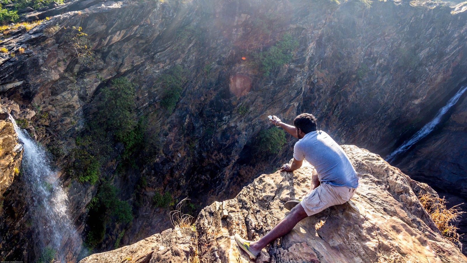
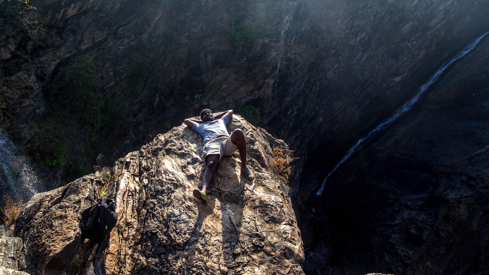
It was an early start, got up at 5 and went out for a tea. Was served with piping hot chilly bajji and tea. The Bajji tempted me to got for 6 back to back and then top it with a tea. After talking to ppl in the tea stall heard about another falls some 20 km from where I was. This place is also called the Kumki point. Sounded interesting, went back to my room, got ready and headed to Kumki point. Kumki point was like a marriage hall 🙁 disappointed, ordered for a tea and again information gathering. Then heard locals know the point and I cannot find it even if I climbed down myself. I was in that spot with no one to guide. By the time I finished my tea, there were two more guys in a cab. The tea’vala asked me to walk along with the cab guy as he will take me to the Kumki point. It was a breath taking view and tried weird angles to capture the falls, it still did not work 🙁
View from Kumki point
This is how the above pic was taken
A quick tutorial on using the DSLR and the cab driver started taking pictures and I got the shot I needed 😉
Kumki point, Jog Falls
Kumki point - Jog Falls
It was time to go back. Packed my stuff from the room and was served with dosa. Finished with my breakfast and headed west, wanted to touch the west coast before I plan to head east again, this time was a place Horlics’mama was talking about, it was Mudeshwar. Headed west and reached Mudeshwar by 11:30 am. I had my bag tied to the rear seat. I cannot carry it along with me. Reached a matam near by, ppl there had agreed to take care of the bike and the bag. Left it there and took my camera bag to explore this place. The beach view, the gopuram structure were all interesting. The Shiva statue was majestic.
Mudeshwar, Karnataka (West most point on this trip)
Clicked few pics, went back to the matam. Answered all the questions they had, where I am coming from, why I am travelling along and so on 😉 Next was to head back east. This time wanted to go a little south, so selected Chikmangalur which is 237km from Mudeshwar. Did not want to go back through Shimoga to have a different flavour, so selected the Sringeri route. En’route stopped and had tender coconut on a beautiful road with sea shore on one side and river running on the other side. Reached Chikmangalur by 5 pm. To find a room and settle down took time. I was all set by 6 pm. With sun running down, wanted to select a place for sun-set photo. Was told about Mullayanagiri. This is the highest peak in Karnataka, this is the highest peak between the Himalayas and the Nilgiris. It is about 20 km from Chikmangalur, should take about 30 min to reach the base, if possible in 20 min. Took the bike on the twisty. Had crossed 30 km with no sign of any peak. Stopped to check the route, was told it was on a parallel road which separates 12km before. I missed the turn and the opportunity to take a sun-set photo. Disappointed, headed back to my room. Went out for dinner, tried Bonda soup (This was the Karnataka version of Sambar vada), butter masala dosa and kalli dosa. To top it had a coffee.
Went to room, with no plan for the next day, it was again time for call an acquaintance/not a friend. Asked for list of places which I can check the next day. Went to bed. The list was prepared and sent.